Tuesday, March 19, 2013

Hermit Park Open Space Slash Pile Burn-Scar Remediation

Hermit Park Open Space is an incredible property and a real gem for trail users and campers in Northern Colorado.  I recently visited Hermit Park for the first time to get a feel for the project area and become familiar with the property.  Not only is the park located in a beautiful setting a few miles east of Estes Park on highway 36 (map), it also has some of the nicest camping spots I've seen in quite a while.  There are even 5 equestrian designated campsites that include a small corral for 2-4 horses.  Larimer County has gone one step further to offer cabin rentals that are fairly secluded from one-another, have their own personal outhouse, a wood burning stove, and a 2-burner propane cook stove.  The icing on the cake is the trail access from Hermit Park.  The Kruger rock trail is about a 3.5 mile round trip and is hiking only.  This trail leads to Kruger rock with views into Rocky Mountain National Park and the city of Estes Park.  For equestrians and mountain bikers, Hermit Park has a connector trail that leads to Lion Gulch and Pierson Park trails for out-and-back adventures.  Mountain bikers could take advantage of some county roads and two-track trails to create a loop ride.  With all of these options and amenities, Hermit Park has definitely made it onto the short list for my family!

Slash pile
The land managers caring for Hermit Park have been cleaning up dead trees, ladder fuels, and the slash (debris) to help remove excess wildland fire fuels from the park.  This kind of management is necessary to help reduce the possibility of large wildfires and help protect park resources.  This also results in piles of wood and debris called slash piles.  The slash piles are left to dry for a season or two until conditions are appropriate for burning.  Burning usually occurs when it is colder and there is more moisture to help reduce the possibility of an escaped fire.  While the overall effect of slash pile burning is positive for the landscape - through the removal of excessive wildland fuels - the burning has a negative impact on the soils immediately below the slash pile.

In a low to moderate severity wildfire, perennial plants usually survive, nutrients are cycled, and vegetation returns quickly, providing competition which helps prevent invasive plant establishment.  During slash pile burns the fire is concentrated and localized.  The soils are heated to a much greater extent and for longer periods of time.  This results in a burned patch where nothing will grow because all of the plants and seeds are killed, the nutrients are burned off, soil microbes are killed, and often there is a residue left over that coats the soil and prevents water from infiltrating into the soil.  The scar that is left over is usually devoid of plant life for a few seasons and is a perfect candidate for invasive plant establishment.  To help prevent invasive plants from establishing and to promote desirable plants, remediation of the burn scar is an important in the early years after the burn.

Slash pile burn scar
Trailcology will be helping Larimer County remediate slash pile burn scars at Hermit Park on April 6th.  We will rake the burn scars to break up the hydrophobic layer of soil, allowing moisture to infiltrate.  Throwing down seed of desirable vegetation will provide a source of native plant material that will also help prevent establishment of invasive plants.  After the seeds have been put down we will follow with a rake to incorporate the seeds, providing better contact with the soils and increasing their chance to germinate.  Finally we will put down a mulch to help protect the seeds from erosion and seed predation.


The project will start at 9:00am on Saturday April 6 and run until 5:00pm.  To register for the project, send an email to Casey Cisneros (cisnerct@co.larimer.co.us) and be sure to let him know that you are registering with Trailcology.

This will be a fun project in a beautiful location!  If you haven't been to Hermit Park Open Space yet then I highly recommend you come out to see it for yourself and provide a helping hand while you're at it!

Happy trails!

Chris


Slash piles and burn scar
Even with all of the grass surrounding this scar, nothing
will grow within it


There are many more slash piles to burn


Saturday, February 23, 2013

Project Details: Indian Creek Riparian Restoration at Devils Backbone

I had the pleasure of meeting with Casey Cisneros and Tim D'Amato of Larimer County for a site visit at Indian Creek.  Casey, Tim, and I walked around the project site talking about potential locations for focusing our restoration efforts.  I snapped a bunch of photos, so let's jump in!
If you look closely you can see the Blue Sky trail where it intersects with the trails from Coyote Ridge and Rimrock Open Space.  The Indian Creek drainage is at the bottom of the descent from the intersection.

Here you can see Blue Sky trail cross right through the Indian Creek drainage and head off to the west toward the Indian Summer loop.


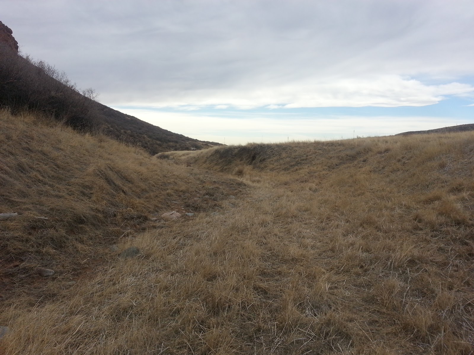
If you stand on the Blue Sky trail in the middle of Indian Creek, you will see this to the South.  This area is severely lacking woody vegetation.  If you were to stand in this exact spot and spin around to the North, you would see thick shrubs, willows, and cottonwoods along the Indian Creek drainage.  

The parcel of land to the North had been fenced off and was managed differently than the parcel that we will be working on and was excluded from heavy livestock use and management.  It is possible that fire was used as a management tool many years ago to improve vegetation production for the livestock.  The fire would have burned off plant material, cycling nutrients back into the soil, and increased the amount and quality of forage the next spring.  Another effect of frequent fire on a landscape is reduced woody vegetation.

Tim and Casey lead the way down Indian Creek!


The drainage is not completely devoid of woody vegetation but the little bit that exists is heavily browsed by wildlife.  This kind of heavy use prohibits adequate growth.

A bend in the creek is currently harboring this little guy, but you can see that the last high flow has deposited a good bit of debris.  Hopefully this tree can help anchor the streambank against high flows in the future.

Some mountain bikers on Blue Sky headed back toward the Coyote Ridge intersection.

It's quite pretty along the creek bottom!  The gentle slope on the left side of the picture may be a good location to focus some of our efforts on.


There were a couple of locations that really stood out as being preferred locations for willows.  In the two pictures above you can see horsetails lining the banks of the creek.  Horsetails are only found in very moist areas and it is likely that these locations experience extended periods of moisture, possibly from a seep.  Willows would have the best chance for survival in these wetter areas.

Wild rose has established on this bank.  Unfortunately, the backdrop isn't in such good shape...

This is a separate drainage heading back up the hill towards the Indian Summer loop.  If we have the time and resources we may start restoring this drainage as well.  If not, we may leave this for another project down the road.


During this project we will be planting willow stakes, bare-root stock, and cottonwood.  Due to the heavy wildlife browsing that we noticed along the creek bottom, we may fence off specific areas to give our plants a better chance of success.

This should be a fun project and it is in a great location to observe your hard work right from the trail! 

I can't wait to work with everyone who has volunteered for this project and if you haven't registered yet, there are still some spaces available!  Be sure to send Casey Cisneros an email (cisnerct@co.larimer.co.us) to register, and be sure to tell him that you want to volunteer with Trailcology!

If you have any questions, feel free to send me an email!  Trailcology@gmail.com

Happy Trails!

Chris


Sunday, February 10, 2013

River Bluffs Open Space Riparian Restoration

Not too long ago I took the opportunity to adventure out to the River Bluffs Open Space to get a first-hand look at the riparian site where we will be working at on March 23rd.  Prior to this visit I had only seen pictures and heard about the site.  I wanted to be sure that I was familiar with the location prior to the project.  If you've never been the River Bluffs you should note that it is important to turn North off of 392 onto South County road 3, immediately after you pass by the Ptarmigan Country Club (before you drive down the hill).  You are only on County road 3 for roughly a 1/2 mile and you will see the Poudre Trail on your right side.  Turn right onto County road 32E and you will soon see the trailhead for River Bluffs Open Space.  Here is a little map that may help you.


My little helpers are pointing out a sign near the River Bluffs trailhead letting us all know that the County has been hard at work to make the Open Space a healthier landscape through habitat restoration.  Habitat restoration has many benefits for the land such as improved wildlife habitat, improved ecological function, and improved hydrologic function.

Shortly after the fenced-off restoration site we came across this lovely bridge over the Poudre River that connected the short River Bluffs trail with the Poudre River Trail.  As a side note, this turned out to be a great place to throw some stones!

After crossing the bridge and turning South we came across a small drainage leading into the Poudre River.  This drainage appears to be fed by the area surrounding the Northeast section of the Ptarmigan Country Club.  On the West side of the Poudre River Trail you notice many willows and woody plants lining the drainage ditch.  However, on the East side of the trail you see the picture above.  This segment has been severely eroded, in part, due to the lack of woody vegetation.  Woody plants have strong root systems that are able to anchor streambanks and prevent erosion.

Some parts of the drainage have been bioengineered to improve the streambank structure.


In this photo you can see the only bit of woody vegetation along this degraded segment.  The Poudre River Trail is immediately adjacent to the tree.


Here you can see the grayish color of erosion matting that was laid down to prevent soil erosion and help anchor plants that were transplanted to the slope.


There is plenty of space for willows and cottonwoods to help stabilize the soils and streambank while also providing habitat for birds and other animals.

This is a picture of the West side of the drainage where you can see far more woody plants.  Walking along this section we could hear birds chirping and wildlife scrambling around in the brush.  

The drainage eventually leads into the Poudre River.


This should be a fun project and I'm excited to see how many plants we can get into the ground.  Our work will directly benefit wildlife and the Poudre River.  I can't wait to see all of you out there for Trailcology's first project!

Don't forget, if you want to register for this project please send an email to Jeffrey Boring at Larimer County (boringjs@co.larimer.co.us).

Happy Trails,

Chris

Tuesday, January 29, 2013

Hermit Park Slash Pile Burn Scar Remediation

As I mentioned last week, there is another project with Larimer County that Trailcology will be helping out with.  This project will remediate small fire scars where timber slash has been piled up and burned.  Management of these fire scars is important to help keep invasive plants from establishing and spreading into native vegetation.  When invasives spread like this it can be very costly to control the spread and try to eradicate the plants.

Slash piles are created when trees are removed for specific management practices related to forest health (recently there have been many beetle-killed trees removed).  The trees and all of the cuttings (slash) are piled up and left to cure until the appropriate conditions are met for burning.  Slash piles are only burned in the late fall to early spring time frame because there is usually more moisture and colder temperatures, which means there is a much lower risk of starting a forest fire.  When the piles are burned they have a strong effect on the soils directly below them.  Because there is so much fuel in an isolated location the soils experience a very extended period of high temperatures.  The heat can cause chemicals in the fuels to release onto the soil surface, creating a hydrophobic layer in the soil - a soil layer that resists water.  Additionally, the high temperature and long duration of the fire effectively sterilizes the soils, killing any seed sources for new plants.  Due to the impermeable soils and lack of seeds, native plants take a much longer time to establish on these small burn patches.  Invasive plants, however, are usually well adapted to establishing on disturbed sites.  This is primarily because of their ability to spread seed (think of dandelion seeds blowing in the wind) and establish themselves by germinating quickly.  Once a single invasive plant is established it will start to spread it's seed and it suddenly becomes a serious management issue.

To help prevent invasive plants from creating little monocultures on the burn scars there are a few simple treatments that we can administer.  It is important to treat these scars in the fall, winter, or spring because that is when the most moisture is available, giving the seeds the best opportunity to germinate when the weather warms up.  The first step is usually to break up the hydrophobic soil layer with a heavy rake.  Second, seeds are applied by hand.  Third, the soil is lightly raked to incorporate the seed.  Finally, the seeds and soil are protected from erosion and predation by applying a mulch of some form.  Then we let mother nature run her course and hope that the desirable native vegetation takes hold.

Here is the project release statement from Larimer County:

On April 6th there will be a volunteer project at Hermit Park Open Space to revegetate some of the fire scars where slash piles were previously burned. We want to do this to discourage weeds from moving into those areas where no other competition is present. Exotic invasive plants colonize disturbed areas with reduced competition from other vegetation, reproduce prolifically and then spread. Currently there are over 80 burn scars and another 150 slash piles that may be burned within the park. We'd like to take this proactive weed management approach because it reduces the use of herbicides and the overall cost, as well as protecting the integrity of the forest community at Hermit Park.

To register for this project please send an email to Casey Cisneros at cisnerct@co.larimer.co.us.  Please indicate that you will be volunteering under Trailcology.

This should be a fun day at a beautiful open space, hope to see you there!


Happy Trails,

Chris
Trailcology@gmail.com

Monday, January 28, 2013

Pineridge and Maxwell Social Hour

If you made it out on the local trails this weekend you probably noticed that they were rather crowded.  I took a casual ride on Sunday afternoon with the goal of enjoying the weather and dry trails.  I also decided that I would take the opportunity to try to canvas some trail users and ask them a series of questions to help me understand more about our local trail use.  Interestingly, I mostly managed to talk to people who have lived in Fort Collins for roughly a year or less.

I asked users four basic questions: (1) What is your preferred means of trail use, (2) what trails do you most often use, (3) what kinds of interactions have you had with other users while on the trail, and (4) what would you like for our trails in the future.  These questions were meant to specifically address how the trails are being used, what trails are most popular and therefore most heavily used, the kind of inter-user interaction that people experience on the trail, and what direction our trail systems may need to go in the future.  I want to make it perfectly clear that I only asked a very small portion of trail users these questions, this was merely to help give me some more direction and begin to get a feel of what the important issues are to our users.  In the future, I would be very interested in doing a much larger study about our users.  For right now though, I would like to share the little bit that I learned yesterday.

I was able to talk with a couple of equestrians, numerous hikers, and several mountain bikers - the trail runners proved difficult to speak with because I didn't want to break up their run.  The first thing that caught my attention was how polite people were when I approached them and how willing they were to speak with me.  The first question about preferred means of trail use was really kind of redundant but I was interested because I wanted to see if some people normally run even though they were on a mountain bike, or maybe they normally mountain bike but were instead out for a hike with their family. It was just an easy way to open up the conversation and gain a little bit more insight into the habits of our users.

The Pineridge and Maxwell Natural Areas trails came up as the most often used trails.  Some people indicated that they normally use these trails on the weekday and then go other places on the weekend, like Horsetooth Mountain Park or Lory State Park.  Coyote Ridge also came up as a popular trail.

I found the conversations about user interactions to be pretty interesting.  The majority of comments were about how fantastic and friendly all of the trails users are in our area, and I would have to agree.  There were a couple minor comments about mountain bikers coming down the Foothills trail behind Hughes Stadium but it sounded as if it was more of an understood situation that hikers just get off of the trail for the mountain bikers - even though mountain bikers are required to yield.  I was also particularly interested in how often the trails outside of Boulder and Lyons came up during the conversations.  There were a number of people who mentioned that things felt different on those trails and that people weren't as friendly or considerate.  Not once did I ask for a comparison of the regions, it just came up naturally.  Interesting.  Once again I can't help but feel that we have an amazing group of trail users in our region!

The final question about the future of the trails didn't have as many comments as the previous questions.  Some of this is related to the users who are relatively new to the area, they just didn't have much of an opinion because they were satisfied with the trails.  Some of the mountain bikers had more input.  Better trail connectivity was the one issue that seemed to come up the most, especially from East to West.  There were a lot of positive comments about how well trails are connected going North to South but people want the connections to make a big loop without having to spend much time on the road.  This was definitely limited to the mountain bikers that I spoke with but I wonder if the trail runners would agree.  We have many long-distance runners in our area who would benefit from a large well-connected loop.  Aside from the connectivity there were also some comments about the quality of the trails, Reservoir Ridge was mentioned specifically.  Maintaining the trails is a yearly job and I'm really hoping that Trailcology can have a positive impact through volunteer efforts to keep our trails in good shape.

More than anything, it was great to be out on the trail and have so many convivial conversations about our trails.  I did gain a bit of insight about our trail users but I don't plan on using those few conversations to direct my goals, they were merely important pieces of the puzzle that will eventually help me build a bigger picture.  I really appreciate the time that those folks took out of their afternoon to chat with me, and I hope that we may cross paths again down the trail.

Happy Trails!

Chris

Monday, January 21, 2013

A Good Day on the Trails at Bobcat Ridge and Some Talk of Alternate Lines

Today I was able to escape for a few hours to enjoy the trails at Bobcat Ridge Natural Area.  I was excited to head into the hills a bit because I had heard that the trails were dry and in good shape, and they certainly were.  We are having some fantastic weather for late January and there were lots of people taking advantage of the nice weather at Bobcat Ridge today.  I had the opportunity to chat with a fair number of trail users and tell them about Trailcology (nothing like grassroots marketing) .  There was a mountain biker named Trent who has only lived in the area for about 8 months, Dave and Jan who have been in the area for about a year, a trail runner named John, and several other couples who's names I didn't catch.  Everyone was incredibly friendly and obviously enjoying the great weather.  Again, I couldn't help but think what a great area we live in!

I wanted to collect some pictures of the Ginny Trail today to talk about alternate lines on the trail.  Some of these lines are manmade using logs that were left after the Bobcat Gulch fire burned through in 2000.  These alternate lines are mostly for mountain bikers but I suspect that there are other users who get a kick out of the novel bits of trail that have been built on the Ginny Trail.  Of course, there may also be some trail users who do not like the alternative lines because it adds confusion to the trail or to their interactions with mountain bikers coming down the trail, I don't know for sure.  I would love to start a dialogue about how different trail users perceive these alternate lines.

Have a look at some of these alternate lines.


This is one of the first alternate lines that you come across as you are going up the Ginny Trail (photo is taken looking down the trail).  This is an interesting line because it completely bisects this section of trail.  Aside from the issues related to riding (or falling) off of the line and through the vegetation, this segment does a good job of separating the adventurous mountain bikers from any other trail users who happen to be at the section at the same time. 


This is a cool section where a log bridge has been built to bisect the trail.  I could see this line being used by hikers and runners in addition to mountain bikers.  You may notice that this bridge is much wider than the log skinnies that are found on the trail.  While this may not be the favorite of some mountain bikers because it is not as challenging as some of the other features, it is a great alternate line choice for novice mountain bikers to explore.  Additionally, this feature has the added benefit of allowing trail users to get off of the north facing segment of trail that will probably be muddy as the snow melts.  Whether intentional or not, this is a well placed piece of trail.


This is the second log skinny that you come across as you come up the Ginny Trail (photo taken looking down the trail).  This log skinny is in a nice location for beginner mountain bikers because there is little to no consequence for falling off.  However, this feature is immediately adjacent to the trail and may present an issue when mountain bikers interact with other users at this location.  Of course, there may be some folks who enjoy watching the mountain bikers ride (or try to ride) this feature.  But for those who are less than thrilled with the location of the feature, it's easy to understand why.  It would be very easy for there to be some negative interactions if mountain bikers don't let the other users pass first.

Obviously I have presented a few worst case scenarios.  I do not believe that there would be very many mountain bikers who are so brazen as to risk crashing into another trail user.  But again, I don't know for sure.  On the flip side, I have also pointed out some really positive points to these alternate lines.  Allowing users to avoid muddy sections and damaging the trail, providing some passing points for users, and providing fun and challenging technical features.

After spending some time on the trail today I noticed a variety of further opportunities for alternate lines.  Lines that give mountain bikers some of the technical terrain that they crave, while also helping to get them off of the main trail and away from hikers, runners, and equestrians who might not favor a mountain biker hurdling down the trail toward them on rocky sections.  I'm not sure where the City of Fort Collins stands on the issue of these alternate lines but they have, at least, been tolerated up to this point.  This would be a question I would like to ask the Natural Areas crew.

Personally, I feel that there is room for more features like these on our local trails, as long as they are created and placed intelligently.  Alternate lines can be problematic when they send mountain bikers shooting off a feature toward the flow of general trail use, but when built and placed appropriately they can provide a number of key benefits to the trail, with a primary benefit being the reduction of unwanted interaction between agressive mountain bikers and the rest of the trail users.

In addition to a few more pictures, I would like to leave you with these questions:

What are your thoughts on alternate lines like these?
What kind of interactions have you experience around alternate line features?
Would you like to see more alternate lines on more of our local trails?

Happy Trails!

Chris


Friday, January 11, 2013

Spring Volunteer Opportunities with Larimer County

As I mentioned just the other day, I have collaborated with Larimer County to help complete some early volunteer projects on two different County properties.  These projects do not involve trail maintenance but instead they address issues on the land near the trails.  This is what I call the "trail system" - the greater landscape around a trail.  Both projects are meant to address concerns around watercourses by planting riparian plants in strategic locations to improve streambank stability.  These projects should be a lot of fun because they get you off the trail and into the water (if you so choose)!

As an avid trail user I often find myself stopping along a trail and staring at the surrounding landscape, soaking it all in.  I use more than just the 18" tread of trail, I use the entire landscape.  It is important to appreciate and respect the surrounding landscape because it can ultimately have an effect on your enjoyment of the trail.  Improving riparian areas near a trail may bring additional wildlife or help stop erosion that may otherwise close a section of trail.  Similarly, treating invasive plants near trails can improve the quality of your experience by keeping your shoes free of seeds or, more importantly, by restoring the native vegetation that is much more beautiful than that of an exotic monoculture and better for the ecology of the land as a whole.

The first project will take place at the River Bluffs Open Space on March 23rd.  Here is the project release:


Larimer County is hosting a Volunteer Habitat Improvement Project at River Bluffs Open Space on Saturday, March 23. The project will run from 9-5. The makeup date is Saturday March 30. The purpose of the project is to restore the riparian corridors of Fossil Creek and the Poudre River by planting trees and shrubs. Over 1,200 plants will be installed, mulched and watered. 

Volunteers are asked to register before the event and must be at least 18 years old or 12-17 years old and accompanied by an adult. A pizza lunch and beverages will be provided. Volunteers will need to wear warm, hardy clothing as they will be outside and on their feet for the entire day. Work gloves and waders are recommended, but not required. Contact Jeffrey Boring at jboring@larimer.org to register.

Even though this Open Space is not as heavily used as many other sites, I still feel that this is a great opportunity for trail users to get out early in 2013 and help make a difference on our public lands.  This is a rather large project and a great chance to meet new people!

The second project will take place in Devil's Backbone along the Blue Sky Trail on the Indian Creek drainage on April 13th.  Here is the project release:

The Larimer County Department of Natural Resources is hosting another Volunteer Habitat Improvement Project at the Devil's Backbone Open Space along the Blue Sky Trail on Saturday, April 13. The project will run from 9-5. The purpose of the project is to restore sections of the riparian corridor of Indian Creek by planting trees and shrubs. Previous to Larimer County taking on management of the valley, key shrub and tree communities along the stream channel had been removed. This project is aimed at assisting the recovery of plant communities in those disturbed areas that support a wide array of wildlife in the area. 

This project will require 12 volunteers - first come, first serve. Volunteers are asked to register before the event and must be at least 18 years old or 12-17 years old and accompanied by an adult. For more information, contact Casey Cisneros through e-mail at  cisnerct@larimer.org.

This is an excellent opportunity for trail users to lend a hand on the land where one of our favorite trails lies.  While this project is not as large, it is still a great opportunity for trail users to get together and help restore some riparian habitat along a great trail.

To register for either of these events, please send the project leader (see release statements above for projects' leader) and I an email with your information and we will get you all setup.  Feel free to email us with any questions or concerns that you may have.  Additionally, please share this information with your trail-loving friends as well!

I can't even begin to explain how excited I am to have these two projects coming up and I hope to see you there!

Happy trails,

Chris
Trailcology@gmail.com