Wednesday, August 7, 2013

Exploring The Gateway Natural Area


Gateway Natural Area is tucked away 15 miles west of Fort Collins along Highway 14 where the North Fork of the Poudre joins the main branch of the river.  The park was Fort Collins' first mountain open space and originally the site of the water filtration plant for the city that opened in 1903. It reopened to the public in 2002.  The park sits in a peaceful valley below and away from the road noise. Although Gateway is locally known as a top-notch family destination with easy-going trails and great scenery, there are still plenty of opportunities for the adventurous type. 

When you arrive at Gateway Natural Area you can avoid the five-dollar parking fee by parking at the top of the road just before Highway 14 turns sharply to the left. Once you get down into the park, you  enter one of the most well maintained picnic areas in the region. With the Poudre River running along the east side of the park it serves as a popular launching point for kayakers and tubers. I’ve definitely spent my fair share of time floating this stretch and it’s a really enjoyable experience.

Once you cross the river you enter a wide trail that transports you into Roosevelt National Forest and continues for 1 mile to the base of Seaman Reservoir.  The ¾ mile Black Powder and ¼ mile long Overlook Trails branch off the main route and provide interesting viewpoints of the devastation from the Picnic Rock (2004) and High Park Fires (2013).  You eventually cross the river again before making the final steep climb to the reservoir, where you're greeted with awesome views and the opportunity to continue hiking.

It’s a dwindling secret that Seaman Reservoir contains some of the best cliff jumping opportunities in the state and if your feeling adventurous continue hiking up the trail to your left at the top of the dam.  The trail zigzags along the hills at the western most point of the reservoir and eventually arrives at a secluded 
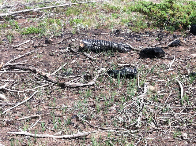
location along the back edge of the lake.  Along the trail you cross through the edge of the Hewlett Burn Area. This area was scorched pretty badly last summer and although you can’t replace the Ponderosa habitat, the vegetation has recovered substantially. Seaman Reservoir serves as an important water source for the City of Greeley and the fire last summer unfortunately forced a lot of debris into the lake. After a mile of steep ups and downs, you reach a ridge where you can launch yourself off the jagged row of cliffs from June-August depending on the water level.  Ranging in size from 8-30 feet, these cliffs should be approached with caution and it’s never a bad idea to check the depth before you jump.  With the typically large crowds that come up here every day of the summer, you are sure to solicit a few hollers when you gracefully fly off the rocks.

If you have the time and an adventurous spirit, continue northwest down the trail where you might even find a rope swing tied to a large tree along the bank.  I wouldn’t recommend attempting this unless the water is really high and you are confident in your rock scrambling ability as the trail becomes less defined the further north you go.

I find Gateway to be one of the most pleasant, accessible and well maintained Natural Areas in Larimer County. It’s a quick 20-minute drive from Fort Collins and definitely holds its fair share of local secrets. Check out the video below for a little taste of what Gateway Natural Area and Seaman Reservoir have to offer.  

-Jon

Hours: Dawn to Dusk (No Overnight Camping)

Directions: Gateway Natural Area is located at 5216 Poudre Canyon Highway (Hwy 14). Take Highway 287 to Highway 14 West, then travel 5.2 miles on Hwy 14 West. Gateway Natural Area is on the right side of the road.


"Up we climb with glad exhilaration." 
—John Muir, The Yosemite, 1912 


(Video Courtesy of Nick Micheletti)

Looking up Gateway from Highway 14. 

Friday, July 19, 2013

Boulder Greenways Weeding on Wheels-Teasel-7/18

Trailcology joined Wildlands Restoration Volunteers and Boulder Greenways thursday evening for a volunteer project along the South Boulder Creek Bike Path. The aim of this project is to eradicate invasive teasel ( (Dipsacus spp.) that is rapidly invading natural areas in Boulder and along the Front Range and displacing native plant populations . Teasel is a biennial plant native to Europe but has quickly spread across the United States and has been classified in Colorado as a Noxious Weed List B Species. According to the Colorado Weed Management Agency, List B includes plants whose continued spread should be stopped and local management agencies are required to implement plans for the eradication of this non-native species. Unfortunately, it thrives in sunny, disturbed areas such as flood plains and along the sides of creeks and irrigation ditches. Our project site on the east side of Boulder has been plagued by both common and cutleaf teasel in the past few years. This is the second year WLRV and Boulder Greenways have worked in this area are there are already visible signs of native plant life returning to this important wildlife corridor. It was pretty cool to join this project and help get rid of this ugly alienesque plant thats invading our state.

Common Teasel
Cutleaf Teasel


Although dark skies threatened rain throughout the evening, our crew was able to stay dry and bushwhack our way along this heavily overgrown section of South Boulder Creek. The method for getting rid of the teasel included: snipping below the top to prevent seeding and then cutting the stalk off as close to the ground as possible. If the teasel was in the flowering stage we cut and bagged the flowers to prevent the spread of the weed.  Although this was simple work, it still felt like a treasure hunt as we searched for teasel hiding in the brush.  We made several passes along the riverbank before concluding for the evening.  It was great to see so much support for this project. 


-Jon

"Greenways are ‘the paths to the future’ as they link people to the outdoors. They 
meet an ever growing need, a need to leave the hectic city (if only for a moment) 
and to experience earth beneath your feet and fresh air in your lungs—to feel life 
and to feel alive. "
-Victoria Louge- Backpacking in the '90s-1995


Not the most scenic section of trail but still important.

We managed to avoid the rain even with  these ominous clouds in the background

Gathering the crew

Ready to cut down the teasel! 


Monday, July 15, 2013

Hermit Park Update 7/15

Back on April 6th, Trailcology went to work remediating and reseeding slash burn scars in Hermit Park Open Space outside Estes Park. The combination gardening and ecological restoration day was one of our most successful projects to date. Roughly 75 slash piles were addressed by the entire volunteer crew.  Today on a cloudy, cool and quiet monday I visited Hermit again to observe our work several months later. The progress is fantastic. Can't wait to return for another project here. The park was so empty and peaceful today. 

Happy Trails!

-Jon 

The monsoon moves in on cue

Some areas exhibit quite a bit of growth

other sites still need additional time and work

Lots of memories from this multi-scar zone

our seeding is paying off

More slash piles were burned in the spring 

Monday, July 8, 2013

Lory State Park: Bridge Reconstruction 7/6/13

Friends of Lory, volunteers and Trailcology continued the effort to rebuild bridges following the Galena Fire in early March. On Saturday, dedicated volunteers completed 75 percent of bridge 8 on the East Valley Trail leaving only bridges 7,9,10 still unfinished. Together we poured concrete to reinforce the existing beams and moved the heavy timber into place over the creek bed.  The reviews of the recently completed bridges are flying in from riders, equestrian users and trail runners who all say these spans are some of the best they have ever seen!  The remaining projects are some of the more challenging tasks as the bridge rebuild moves ahead into phase 2. There are plenty more volunteer days scheduled throughout July.

Sign up here:

Lory State Park Bridge Rebuild Crew Sign Up

View the project and closure map: West Valley Trail has reopened!

Lory State Park Map

Enjoy the photos!

-Jon

"So much work remains to be done in this unfinished and imperfect world that 
none of us can justify standing on the sidelines. Especially in a society like ours, 
volunteering is an expression of democracy in its purest form. For the volunteer is 
a participant, not a looker-on, and participation is the democratic process."

Eunice Kennedy Shriver
President’s Commission on Americans Outdoors, 
Report and Recommendations to the President of the United States, 1986


Wednesday, July 3, 2013

Volunteers for Outdoor Colorado: Continental Divide Trail Construction, Clear Creek Reservoir, 7/28-7/30


Trailcology made a stop on the Continental Divide Trail this past weekend for 2 days of trail restoration and rerouting near the historic mining town of Winfield between Leadville and Buena Vista. Together the Continental Divide Trail System runs 3,100 miles between Canada and Mexico. It’s estimated that the trail is 70 % complete and only about 24 people per year attempt to complete the entire route. In conjunction with Volunteers for Outdoor Colorado (VOC) and the U.S Forest Service there is an ongoing effort to move this Colorado section of the trail further away from the 4x4 road and clear it of debris for safer access. Ultimately, the goal is to connect with the extremely popular Lake Ann Trail located in the middle of the towering Collegiate Peaks Wilderness. This is one of the more scenic areas I’ve had the opportunity to visit and there are an endless array of climbing opportunities in the area including, Missouri Mountain, Huron Peak and La Plata Peak, three of the smaller 14ers in the state.  The area is extremely popular with campers and backpackers so it’s become an urgent necessity to repair and clean up the trail.  This is one of 9 weekends that VOC will spend in this area over the summer and more volunteers are definitely needed.

                Over the weekend our group attacked and graded more than 500 feet of trail above Winfield and built a lengthy addition to the rock ‘turnpike’ that crosses over the wetlands at the base of Granite Mountain and the Three Apostles.  On Saturday, our crew mostly focused on carving the upslope of the trail to a 45 degree angle to allow for good water flow and developing a solid ‘critical edge’ on the downslope of the trail. We also removed boulders and stacked and sorted them according to size for construction of the ‘turnpike’.  Because there was an old mining road adjacent to the new section of trail, we used the debris from our excavation to cover up the road and keep people on the trail. After a long day of work we returned to the campsite for cold beer and a delicious dinner of biscuits, chicken stroganoff and red velvet cake.  Since the fire ban prevented us from partaking in the main event of any good group camp-out, most people chose to retire to their tents early after a long day of work.

                Sunday morning, we arrived at the worksite with a slightly smaller crew after a few volunteers departed the night before. We quickly got to work continuing the ‘turnpike ‘and cleaning up the trail from yesterday’s work.  Our focus was on continuing the rockwork and covering a washed out portion of trail above where we worked the day before. This stage of the project was my first experience using a rock sling and bars to haul boulders and I have to say it was extremely rewarding work.  Although it took us 10-20 minutes each time to get the rocks up from the lower portion of the trail we made the process more enjoyable with plenty of lively and encouraging conversation.  Other volunteers worked to chip larger rocks and prepare the upper sections of trail for future work. When we ended on Sunday afternoon it was amazing to see the progress that was made over the weekend. I can't wait to get up here again and see the finished product that is years in the making.


Enjoy the Photo Gallery:
Happy Trails!

-Jon


"A first-rate trails system can only be created by people."
President's Commission on Americans Outdoors

1987

Americans and the Outdoors


Wednesday, June 26, 2013

WRV Crew Leader Training

Crew Leader training was this weekend and I had an awesome time learning leadership and ecological restoration skills in one of the last remaining Civilian Conservation Corp Camps in the United States. The CCC was formed post Great Depression and operated from 1933 to 1942. They offered thousands of men rewarding work and the opportunity to rejuvenate the stagnant economy. The CCC is responsible for building some of our nation’s finest parks and highways including, Red Rocks Amphitheater which opened in 1941. There were once more than 4,500 of these camps but only a handful remain so it was extra special to be sitting in the birthplace of the greatest music venue in the world. The training was taught by the amazing staff at Wildlands RestorationVolunteers (WRV) and followed the comprehensive crew leadership manual provided by The Outdoor Stewardship Institute (OSI).  Throughout the weekend, Denver Mountain Parks graciously provided us space in an old CCC  hall where we examined topics ranging from dealing with different learning styles, conflict management and the proper methods for carrying, using, storing and safely engaging with tools. We even got a really cool history lesson about the camp from a DMP employee on Sunday morning.  We also learned how to properly assess your crew, provide praise, recognition and feedback and follow the correct agency protocols on projects. There were a variety of different WRV staff members present at the trainings and each module took on a slightly different feel according to the personality of the instructor.  

CCC Camp-Morrison, CO
 After spending the morning indoors learning and going through exercises, we ventured to Red Rocks in the afternoon to practice the skills we learned. Saturday afternoon was spent on the edge of the lower south lot at Red Rocks where we learned to dig seed and place erosion matting in a highly degraded and sensitive area. Although we had limited time on Saturday, I really enjoyed the hands on practice with seeding and it was awesome to see our new group collaborating so efficiently.


Red Rocks Social Trail
Hard At Work Laying Coconut Fiber Erosion Matting
Nate In Action
Sunday involved more hands on training as we ventured to a popular and less than desirable ‘social trail’ at Red Rocks to practice transplanting and erosion control techniques.  The park is cracking down on these illegal social trails that slither throughout the park and we were responsible for closing one of the more frequented routes. The first part of the morning was spent digging up shrubs and grasses and transplanting them on the social trail to decrease the potential use. We also gathered slash and placed it over the trail to prevent people from entering the area. In the afternoon we switched gears and learned to install rock structures to prevent erosion and control the flow of water.  This was my favorite part of the weekend as I quickly learned that it’s insanely fun to gather rocks and fit them like puzzle pieces into the right areas. After this, we concluded our training by practicing various crew scenarios. We learned to deal with the volatile husband and wife tandem, the overly eager distracted volunteer and the extremely dehydrated worker. Big thanks to Nate for being the best and most calm instructor possible through these scenarios.

Tremendous View

After this weekend I certainly feel much more confident leading a crew and can’t wait to get out there and mentor on a few more projects. Although the technical aspect of each project is something I’m still learning about, I’m anticipating this knowledge will grow as I continue to volunteer . Thanks to WRV and the Denver Mountain Parks for a fantastic weekend!


Enjoy the Pictures!

-Jon


"Trails have multiple values and their benefits reach far beyond recreation. Trails can 
enrich the quality of life for individuals, make communities more livable, and 
protect, nurture, and showcase America’s grandeur by traversing areas of natural 
beauty, distinctive geography, historic significance, and ecological diversity. Trails 
are important for the nation’s health, economy, resource protection and education." 

American Trails, Trails for All Americans report, 1990 


Thursday, June 20, 2013

Repairing Bridges In Lory State Park


The restoration effort is fully underway at Lory State Park following the devastating Galena Fire that roared through the park in early March. Although the cause of the fire was eventually determined to be accidental, 10 multi-use wooden bridges important for resource protection and trail safety were completely destroyed in the fire. This prompted the Friends of Lory State Park to launch a volunteer initiative to repair the bridges and safely reopen the valley trails that were scarred by the fire. 
March 15th 2013

Along with the assistance of The Fort Collins Kiwanis Club, these bridges will be slowly replaced over the next month. I was able to get out on an initial volunteer day and had an awesome time leveling and placing the beams for the new bridges and staging materials throughout the park. Replacing these bridges is no easy task, as many require new concrete pillars to be placed. Today's action was on the West Valley Trail where we were able to finish construction on one of the priority bridges.  


The goal is try to be prepared for the 3rd annual “40 in the Fort” endurance mountain bike race on June 29th.  The work was a concentrated effort that involved staging materials, sawing wood and leveling out the trail for the new structure. We also dug down and removed a massive 9-foot railroad tie that was holding the old bridge in place. Although we made significant progress, there is still plenty of work to be done and volunteers are desperately needed. Friends of Lory have set up a sign up page for the bridge repair, which can be found here.  This is extremely rewarding work and I highly recommend putting your mark on the fire restoration effort.  The Park has smartly provided a detailed map of the damaged bridges and closed trails. Check it out; you can clearly see the path that the fire took through the park.